UBSEDS25
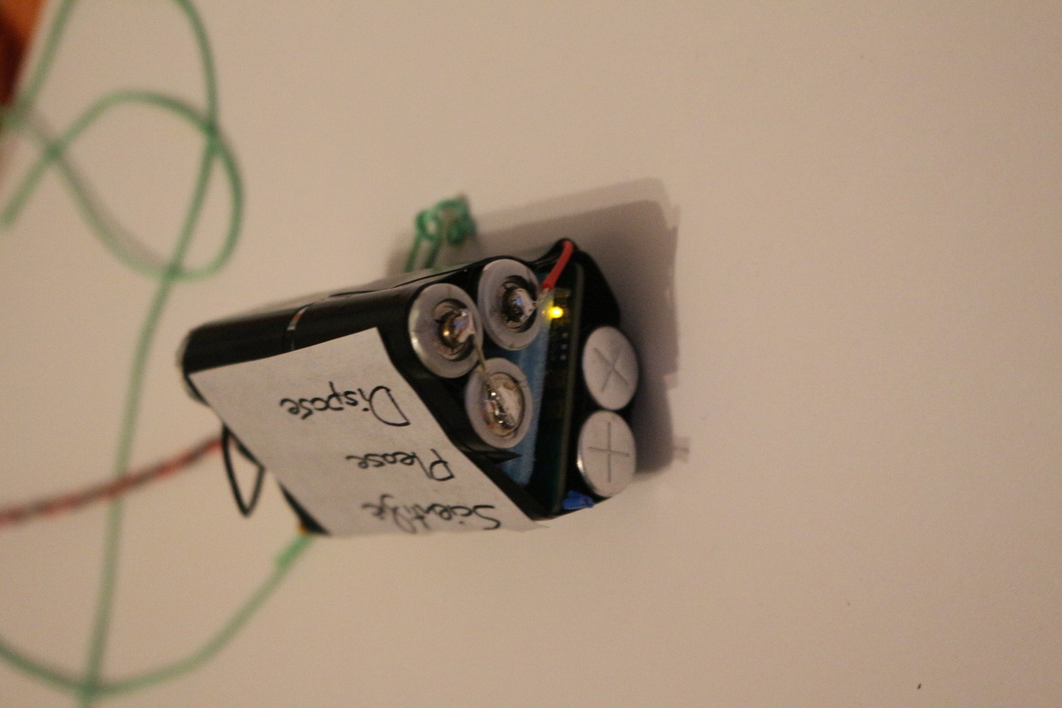
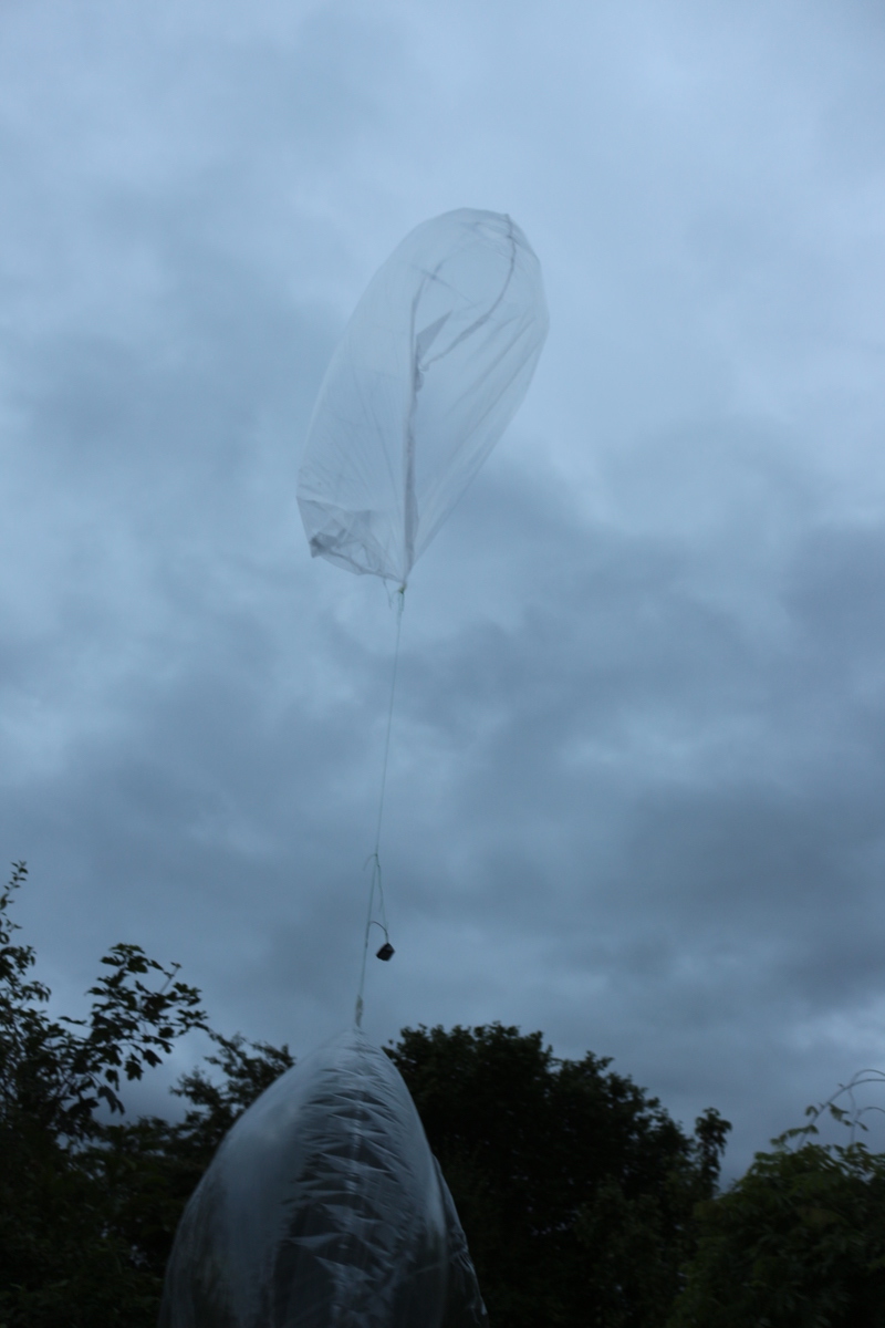
UBSEDS25 is a superpressure balloon launched by our student society. It carries a microcontroller and Raspberry Pi Zero to record telemetry and take pictures. These are then transmitted using ISM band and Amateur radio.
The superpressure balloon aims to float at a steady altitude of about 13km. Previous flights have lasted several months at this altitude.
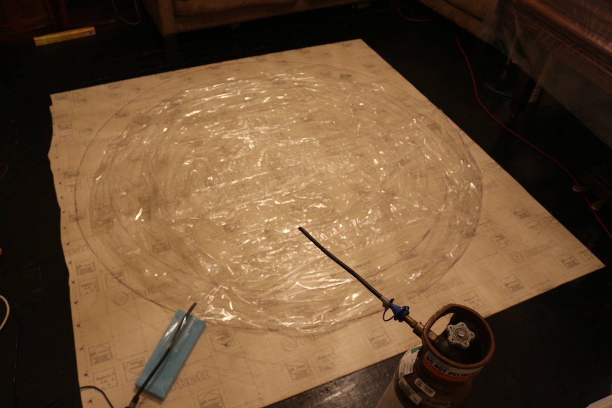
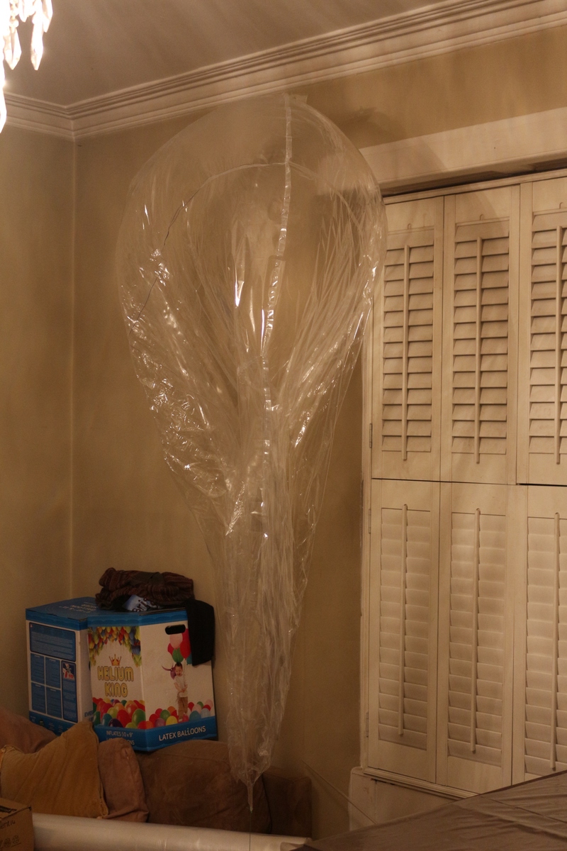
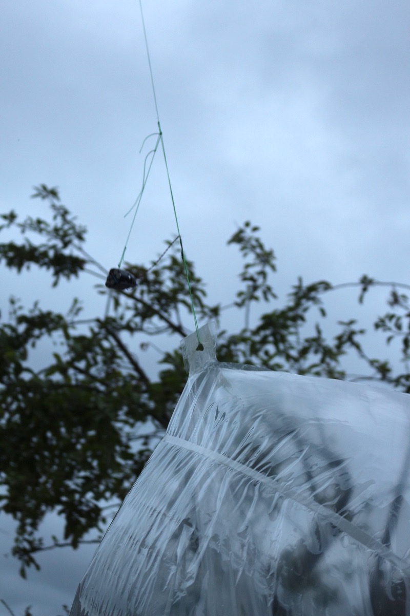
The UBSEDS25 balloon was built from 50 micron thick PA-EVOH-PE multilayer film and was 1.9 meters in diameter. This size means the longest axis of the balloon and payload combined is more than 2 meters, and so a NOTAM was required and obtained for the launch. This launch was unusual as the conditions were cloudy at launch. A 2nd “tow balloon” was used to pull the main balloon through the cloud deck. This tow balloon was timed to disconnect at 05.55 BST, and this successfully occurred at an altitude of 4.6km (15,000 ft).
Instructions for 300 baud RTTY
Mass Table
The mass that can be carried by the balloon is limited. For more detail about the balloon design see Richard’s talk at the UKHAS Conference 2016.
This table does not include details of the tow balloon. See the section below.
| Mass | |
| Tracker incl. Pi Zero | 63.5g |
| Cutdown | 24.5g |
| Streamer | 3.3g |
| Line etc. | 2.2g |
| Total Payload | 93.5g |
| Free Lift | 22g |
| Total Lift | 116g |
The flight achieved a stable altitude of 12.8 km 2.5 hours after launch. The free lift was reduced to about 20g after the previous UBSEDS24 (which used a higher free lift) was lost after a relatively short flight.
Transmissions
The tracker transmits once per minute during launch and when solar power is available. Otherwise it transmits every two minutes, if power is available. At night it may be too cold even for battery operation.
UHF 434.6MHz
Telemetry is transmitted using the error-correcting Contestia 16/1000 mode on 434.635MHz USB.
300 baud RTTY is used for image downlink, except when GMSK is used (see below). These images can be found here. Instructions for configuring dl-fldigi are here.
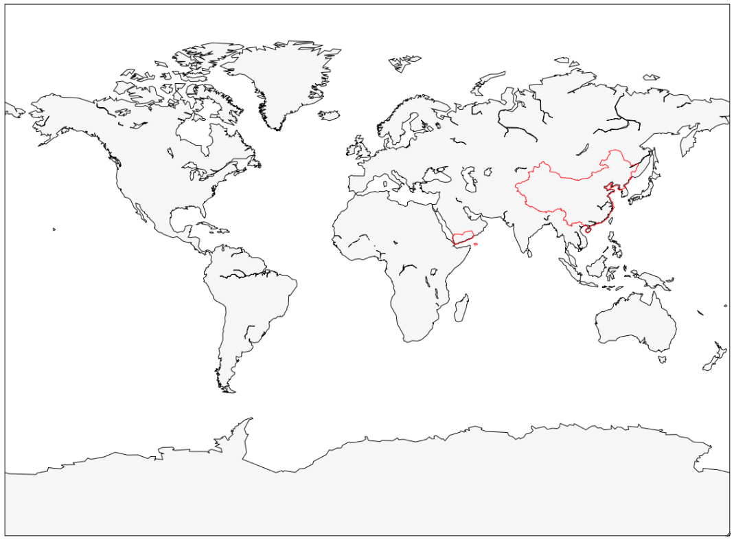
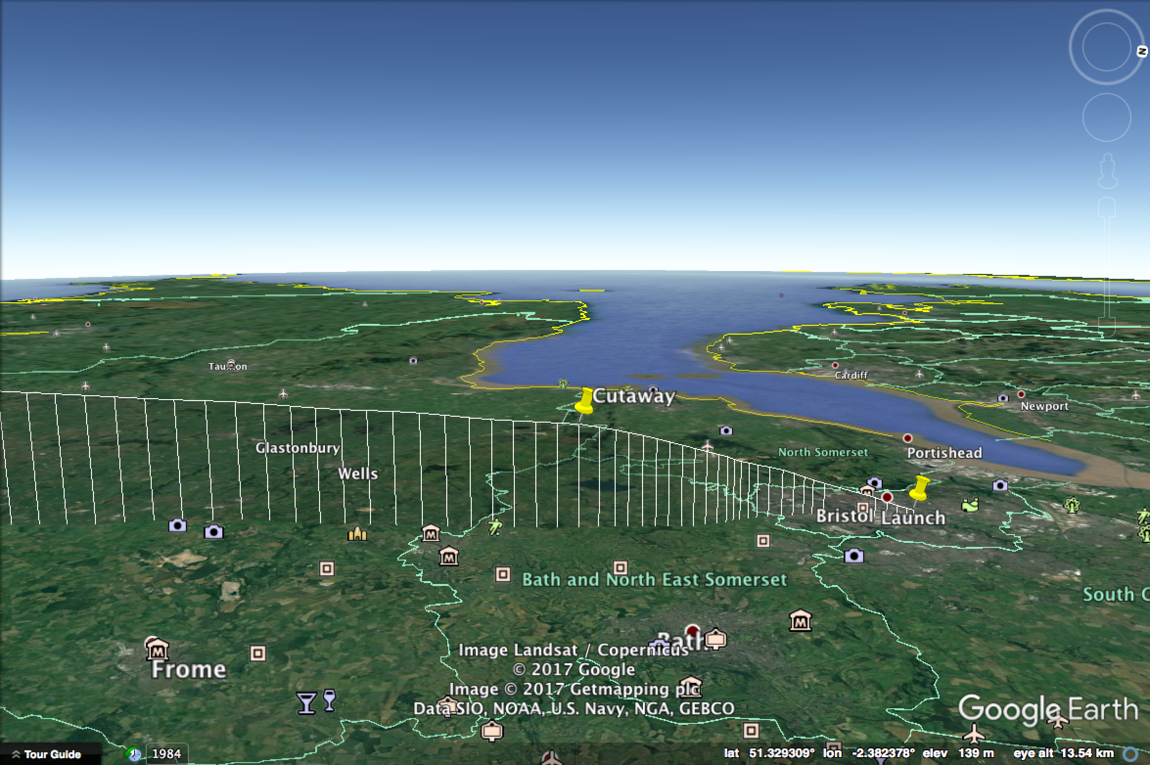
Some countries do not allow UHF ISM band operation. Therefore UHF is only transmitted outside the red lines on the geofence below.
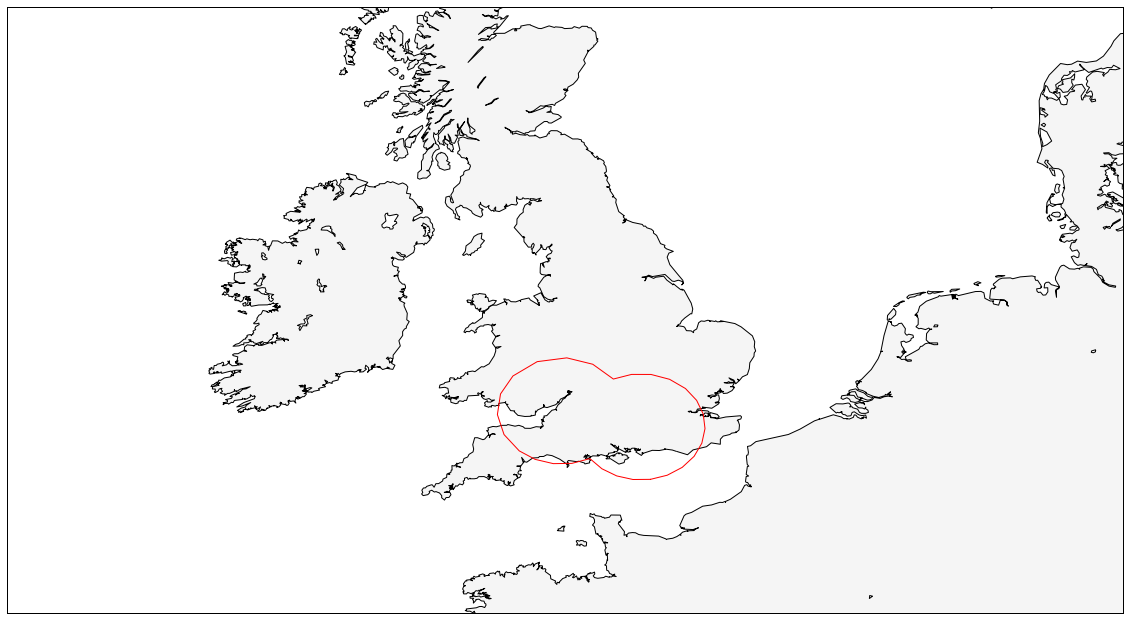
This band is also used for GMSK. GMSK is used to downlink images within the red area on this map. The PER was too high to recover any images.
APRS M0SBU-5 / AD6AM-5
For many countries the balloon transmits APRS packets on local frequencies. In particular this is 144.8MHz in Europe, 144.66MHz in Japan and 144.39MHz in North America.
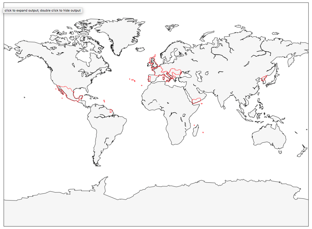
Some countries do not allow aeronautical mobile operation, which limits the balloon from using the amateur bands. Therefore APRS is only transmitted outside the red lines on the geofence below.
Tow Balloon
Habhub tracker
Statistics
- Total distance traveled:
3174.0km - Great circle distance:
1887.4km - Flight duration:
1 day, 15 hours - Maximum altitude:
13.1km - Countries passed through:


Plots
Resources
- Geoff G8DHE Images
- HAB Telemetry Visualisation
- KML Flight Map
- KML Flight Map With Images
- Superpressure parameters for this flight
- APRS log file
Listeners
Thank you to all listeners who tracked this flight!
Total: 54
| Callsign | Telemetry Lines Received | Longest Path |
| G8FJG_v
|
137 | 425.8km |
| 0x17
|
133 | 271.2km |
| G1BLO
|
81 | 396.3km |
| G8FJG_rtl_azel
|
76 | 260.3km |
| EA1FAQ-3 | 67 | |
| G8KNN
|
64 | 387.0km |
| M0NRD
|
60 | 410.4km |
| EB7GYR-1 | 44 | |
| G8DHE-1
|
37 | 349.5km |
| ED4ZAC-3 | 37 | |
| EA1WS | 33 | |
| ED7ZAD-3 | 28 | |
| EB1TK-5 | 28 | |
| BACKLOG | 27 | |
| M0SBU-ax/p
|
27 | 23.5km |
| F6DZR-3 | 25 | |
| M0SBU
|
21 | 135.7km |
| G8FJG_v1
|
19 | 328.2km |
| IW9GTD-11 | 19 | |
| IS0CAP | 18 | |
| ED2ZAE-5 | 18 | |
| SV3CIX | 18 | 2455.3km |
| EA4RKU | 16 | |
| ED1ZAR-3 | 16 | |
| F4GUK
|
15 | 445.6km |
| F5PHW-3 | 14 | |
| F5OPV-10 | 14 | |
| G1DYQ
|
12 | 295.6km |
| F1ZGE-3 | 11 | |
| IS0AML-12 | 9 | |
| ED2ZAD-5 | 9 | |
| ED4ZAF-3 | 8 | |
| EA5AHQ-10 | 7 | |
| EA5URJ-10 | 7 | |
| EA5AHQ-15 | 6 | |
| IH9PFY | 6 | |
| EA5URV-10 | 5 | |
| CT1ENI-8 | 4 | |
| EA6VQ-15 | 4 | |
| M0ZOS
|
4 | 90.9km |
| CT1AKV | 4 | |
| CT2IAG | 3 | |
| IS0CAP-7 | 3 | |
| F5LRQ-3 | 3 | |
| ED1YAP-3 | 3 | |
| G8IMN
|
2 | 420.3km |
| F4FAP | 2 | |
| F6FDN-3 | 1 | |
| IZ0DCK | 1 | |
| ED4YAG-3 | 1 | |
| EA7CRT | 1 | |
| M0BIW | 1 | |
| F5ZZC-4 | 1 | |
| ED1ZAX-3 | 1 |